He Who Controls the Mountains Controls the Land: The Palestinian Authority’s Dangerous Plan to Seize the High Ground in Judea and Samaria
By Elisha Yered
Originally published in Olam Katan News | August 27, 2026/14 Elul 5786
The recent uproar surrounding the Jewish presence at Tel Talpiot revealed a small glimpse of the clash of titans taking place over the past decade on the mountain peaks of Judea and Samaria. After the Palestinian Authority acted effectively as part of a strategic plan, Jews have recently begun to fight back.
Plus: What are the vital strongholds of control, and how many of them remain in enemy hands? Part I of a special project in Olam Katan.
***
Unlike other ministers in the Palestinian Authority, Walid Assaf knew the battle for open spaces not just from an air-conditioned office. He did not spring up from the shiny corridors of the government campus in Ramallah; he came from the field, straight from long years in Israeli prison for terrorist activities.
The combination he possessed — organizational capability, a broad strategic vision, and fighting shoulder-to-shoulder in the field — earned him the coveted role: Minister for the Struggle Against the Jewish Dwellings and the Border.
The mission of the ministry he headed was exactly as its name states: a struggle—including a violent one if necessary—against the habitation of Jews in Judea and Samaria, in order to restrict its steps and ensure that a Palestinian state would be established in its place. During the Palestinian Authority’s heyday, Assaf unexpectedly announced one day that a new strategic plan was underway. By late 2020 on the Christian calendar, the activities of the “Colonization and Wall Resistance Commission” under Assaf’s leadership reached a new peak.
Pioneer Jewish resettlement was just beginning to awaken and fight back, while the Palestinian Authority had already concluded 11 years of activity under the Fayyad Plan.
Within a few months, the commission initiated dozens of violent rampages against newly-established hilltop farms and communities, organized violent provocations during the olive harvest, and conducted a series of blitz operations to seize land and establish facts on the ground at Arab outposts on strategic points. The violent operational pattern of Assaf and his activists was systematic and predictable, yet no one was arrested.
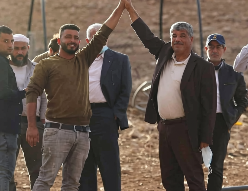
Walid Assaf, on the right. Photo: Uncredited.
Satisfied with the list of achievements he gathered in the campaign for open lands, Assaf decided to leap to the next ambitious goal. Together with his ministry’s field coordinators —most of whom were also released terrorists — the Palestinian minister outlined a plan targeting the conquest of the highest mountain peaks in Judea and Samaria.
The strategy of the plan was simple: Presence in open terrain is a nice thing, but whoever takes up these high strongholds will be the one who controls everything at the moment of truth.
The PA Launched a Plan to Conquer 17 Mountain Peaks in Judea and Samaria
The deceptively innocent name chosen for the plan was “The National Campaign to Defend Mountain Peaks.” Defense against whom? Against the very inheritors of the Land of Israel—the Jews, of course. At the campaign’s launch, held at Mount Ebal, Assaf announced that the plan would initially cover seventeen mountain peaks across Judea and Samaria. The plan went into action immediately and was far from limited to mere declarations and conferences. The set goal was the rapid conquest of these peaks.
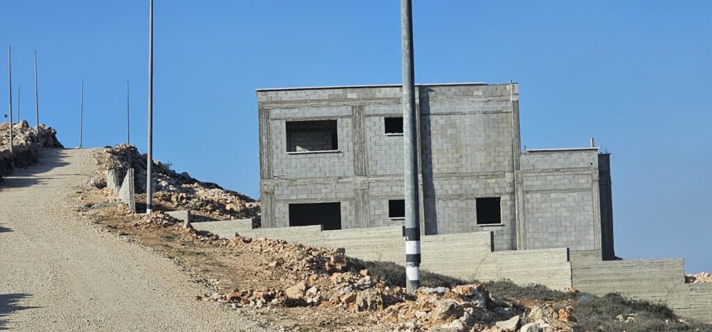
Infrastructure, intensive construction and extensive Arab development in Jabal Ain Ina as part of the PA plan to conquer the mountain ridges. Photo: Uncredited.
Together with local village councils, the Palestinian Authority began facilitating Arab access to the mountain ridges. Dirt roads were carved out and paved with kurkar and asphalt in a short time, water and electricity infrastructure was installed, and Assaf’s office moved to establish facts on the ground. Hundreds of olive trees were planted on the mountain slopes during high-attendance events. A few days of tractor work, a day of planting with dozens of activists, and a check mark could be placed next to “seizing a vast area with minimal investment.”
Following the plantings came construction, which sprouted like mushrooms after rain.
Within a few years, controlling ridges that were once barren rocky grounds were captured and turned into forward extensions of the neighboring villages. The Palestinian Authority developed the infrastructure, subsidized costs, and donated building materials, while local Arabs rushed to capitalize on the opportunity. To understand even a fraction of the targets the Palestinian Authority marked out, where a battle of titans is raging right now, and which assets we risk losing at any moment, we will conduct a partial overview of the strongholds of control in Judea and Samaria.
The Mountain Peaks
A mountain’s elevation above sea level is undoubtedly one of the main elements making a ridge a vital stronghold of control; however, the highest mountains are not always first on the strategic points list. Everything actually depends on the space surrounding each point. If a mountain is significantly higher than its neighbors, it automatically becomes a central point of control. So, because this parameter usually provides a distinct advantage, we begin this week with a review of the ten highest mountains and ridges in Judea and Samaria:
1. Halhul Ridge
Peak point: Nabi Yunis and Beit Anot, 1,024 meters.
The ridge commands Route 60 leading to Hebron and overlooks all the way to the resettlement of Karmei Tzur and the center of Gush Etzion. For years, the Palestinian Authority worked to seize its knolls and established, together with Arab villagers, houses and extensive agriculture along its slopes and spine.
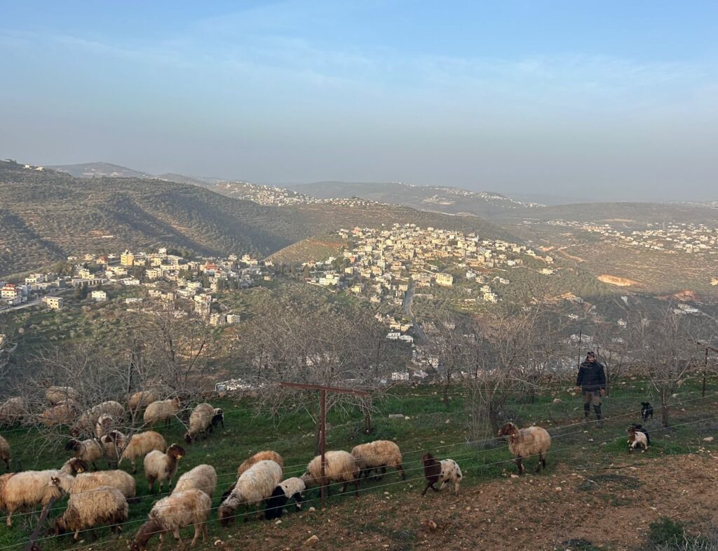
Tel Talpiot Hill at the summit of Jabal Ain Ina. Photo: Uncredited
After nearly two decades of struggle waged by the Nachala movement and local residents, a resettlement point named Ma’alot Halhul was established on the ridge about a year ago and was later officially approved as a permanent resettlement. The yishuv was established on one of the hillocks on top of the ridge, but not at its highest point. One of the highest summits is currently held by the Beit Anot hill, established later through sheep grazing, while the second summit sits above the Glass Junction and remains under Arab control.
2. Baal Hatzor Ridge
Peak point: Tel al-Atzur, 1,016 meters.
The ridge commands the resettlements of Ofra and Kochav HaShachar and overlooks almost all the mountains in Judea and Samaria, from Samaria to Gush Etzion. For years it was left completely neglected, except for a sensitive strategic air control base that gradually became surrounded by a choking ring of Arab construction reaching within touching distance. In recent years, the ridge has been filling with farms and outposts that crack this Arab chokehold, but much work remains to be done.
One of the shoulders of the ridge, rising to an elevation of 940 meters located near the village of Mazra’a ash-Sharqiya, still remains neglected and poses a severe security hazard. Massive Arab construction and nonstop development work occur there. About two years ago, an Arab sniper stood on the mountain—absurdly classified as Area B despite being a clear observation post over Route 60—fired a precise shot, and hit a female Border Police officer 800 meters away.
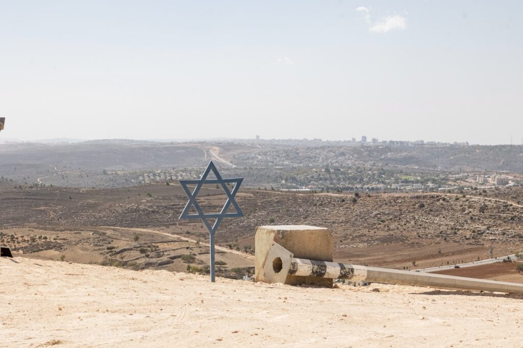
A view of the Chesed L’Abraham Farm on Mount Hatzor – south of the settlement of Ofra. Photo: Uncredited
3. Sa’ir–Kuziba Ridge
Peak point: Ras al-Tawarah, 1,012 meters.
Situated east of the Halhul Ridge, it consists of several peaks designated as Area B and is currently under full Arab control. The ancient settlements of Tziur and Koziba were historically located here. Bar Kokhba, who was likely a native of the area, was originally named Bar Koziba after his home village.
Control of the ridge is essential for connecting the center of Gush Etzion to its eastern side.
Many springs flow from the mountain, from which the aqueduct that led water to Jerusalem through tunnels and bridges collected. Control of the ridge is crucial for linking the center of Gush Etzion to its east, which today are separated from each other by a hostile Arab bloc.
4. Hebron–Kiryat Arba
Peak point: Giv’at HaHarsina, The Thousand Ridge, and Giv’at Gal (Jabal Jalis), 1,008 meters.
These high points are populated by Jews, surrounded by dense Arab construction.
5. Neve Daniel–Elazar–Efrat
Peak point: Mitzpor HaElef (The 1,000 Lookout), 996 meters.
The entire area is settled by Jews.
Additional high points: Neve Daniel (984m), Sde Boaz (956m), Rosh Tzurim (955m).
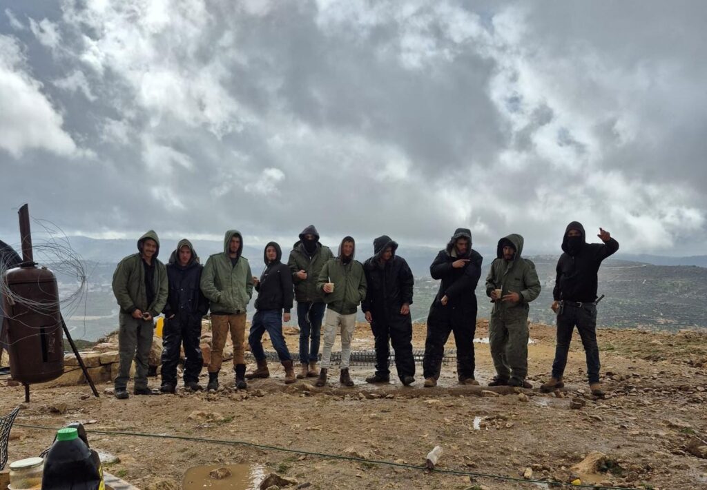
First winter with Jewish presence on the summit of Jabal Ain Ina. No credit noted.
6. Mount Ebal
Peak point: 940 meters.
The summit is designated Area C, but its slopes almost to the top are designated Areas A and B. For years, the Palestinian Authority ran numerous operations to establish control over the ridge, which remained empty of Jews except for a small military base at its peak. The Arab struggle to seize the ridge included infrastructure breaches, preparing agricultural land, and executing numerous terror attacks against a Jewish farm established there, which was ultimately evacuated under PA pressure.
Recently, a Jewish settlement was established at the summit alongside a resettlement point on its eastern slopes toward Joshua’s Altar. The remaining slopes still face an active threat of Arab takeover, or one already taking place.
7. Har Gilo (Mount Gilo)
Peak point: 927 meters.
At the top of the ridge, located in the northern part of Gush Etzion, there is a Jewish resettlement, surrounded by dense Arab construction from the village of Beit Jala.
8. Ma’on Ridge
Peak point: Ras al-Tawamin, 911 meters.
The ridge commands the resettlements of Ma’on, Susya, and Yatir. For years, the Arab Mur clan controlled the area, but they were evicted after clan members murdered Yair Har Sinai (may G-d avenge his blood). However, in an infuriating move, the IDF permitted their return. About three years ago, after a prolonged campaign by local settlement activists, the Arab intruders were expelled a second time. Today, the ridge is home to Sde Harel Farm—established in memory of Harel Masoud (may G-d avenge his blood).
9. Psagot–Beit El
Peak point: 909 meters.
Both high points hold Jewish resettlements, although a significant portion of the surrounding area remains under Arab control.
10. Jabal Ain Ina
Peak point: 904 meters.
The ridge is a strategic peak situated on the seam line between Binyamin and the rest of the Samaria region, overlooking the Shilo bloc from the south, Giv’at HaYovel in Eli from the west, Migdalim from the east, and Rechelim and Evyatar from the north.
Despite its security importance, the mountain is designated Area B in the Oslo Accords. Because it is a key point for regional control, the Palestinian Authority has made extensive efforts in recent years to seize it: Building numerous homes (most of which remain uninhabited), breaking ground and establishing infrastructure. About eight months ago, a Jewish resettlement point, meriting the name Tel Talpiot, was established at the top of the mountain. Since its founding, the hill has faced nonstop Arab attacks alongside attempts by local villages to complete a chokehold around the mountain and ascend to its summit.
These days, the struggle for Jewish control of the mountain is at its peak. The media “storm” over the “siege at Qusra,” which erupted into our lives in the past two weeks and managed to mislead innocent Jews who had fallen into a trap, was the direct result of this massive effort by the enemy, which had been orchestrating its plan for months.