The Plan to Take the Mountain Peaks in Judea and Samaria: What Has Changed on the Ground — and the High Points Israel May Lose
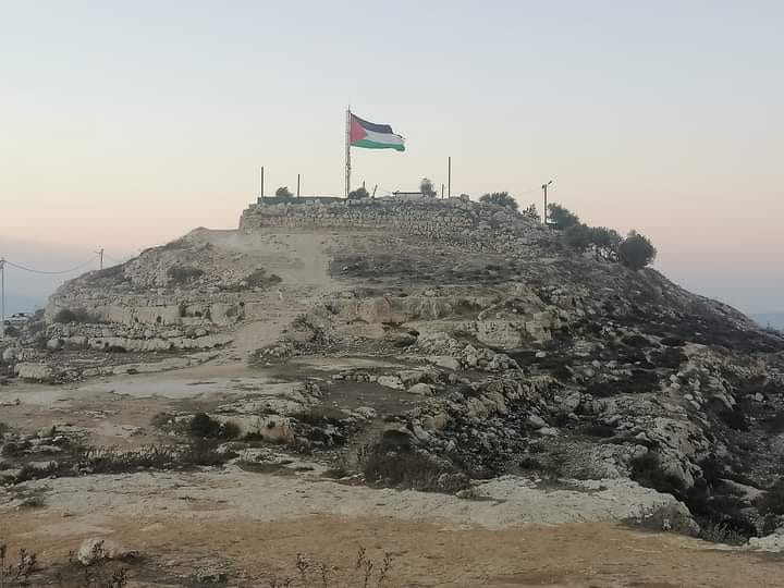
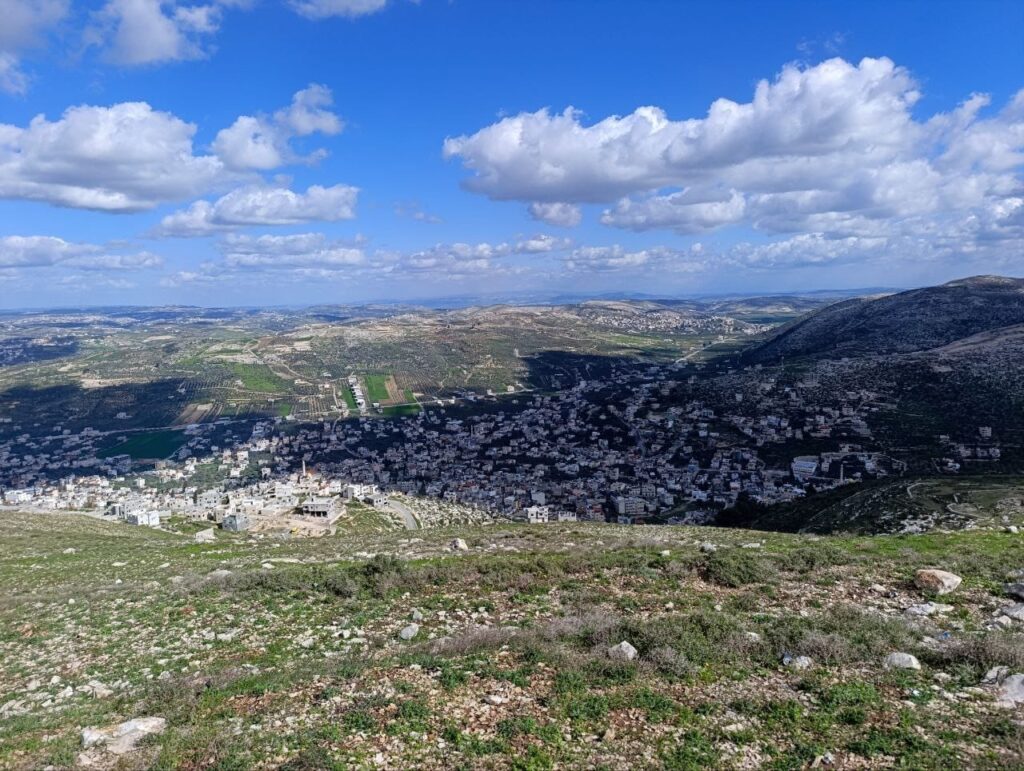
Jebel Turuja (Jabal Truja). Photo: uncredited
By Elisha Yered
Israel has already left the fences around some communities and taken nearby hilltops. The next step is to take the high points deeper inland. The army’s regional commander understood this in minutes when he stood on one of those peaks. But fear of world pressure may let the other side take them first. This is a race against time.
Originally published on Olam Katan on 21 Elul 5786 — September 3, 2026
***
A short guide to the terms used below:
— Judea and Samaria is the Biblical name for the area being discussed here.
— Under the Oslo Accords, the land was split into:
- Area A (Palestinian Authority civil and security control)
- Area B (PA civil control, Israeli security control) and
- Area C (full Israeli control)
— A farm here means a small Jewish herding outpost: a few people, animals, and a foothold on the land.
***
For a long time, a wall of mountains saved the Jordan Valley.
In northern Samaria, groups of thugs in Tammun and Tubas were armed and active. They ambushed soldiers and tried to spread. Yet the Jewish communities in the Jordan Valley, just next door, were strangely left alone. Militancy hit many other places in Israel. It skipped them.
Why? Not because of a thick line of elite troops. Because of the land itself.
A long mountain ridge runs north to south along the edge of the desert. It sits between terror-filled Samaria and the valleys to the east. These are real ridges, with only narrow passes between them: Mount Bezek in the north, then Gadir and Tammun.
The army put a small guard post or checkpoint in every pass. That made it hard for hard-core criminal groups to break out east. It worked for a while. But it also became a mental border. West of the ridge, an Arab-controlled area grew with little interference. Israeli security focused on stopping spillover, not on what was happening “over the mountains.”
Like every fixed border, this one broke.
———
In 2022, three thugs bent on murder from northern Samaria planned an attack in the Jordan Valley. They drove a pickup with a large diesel tank and rifles. Using dirt tracks, and helped by recent Arab takeover of land, they crossed between Mount Gadir and Mount Tammun without being seen. On Allon Road they attacked a bus of new recruits. They opened fire, then tried to spray diesel on the bus to burn the people inside.
Their escape failed. The leftover diesel caught fire. Two attackers were badly wounded and caught. The third got away and was killed months later.
Two years later, homicide hit the same quiet roads again. A cell left Tubas through the valley between Gadir and Bezek, ambushed cars on Allon Road, and murdered Yonatan Deutsch. They had prepared another escape route near Mount Bezek. They knew the ground better than the soldiers chasing them.
Those two attacks woke up the people on nearby Jewish farms. The farms in the low yellow valleys were no longer enough. They needed the mountain tops.
With help from activists from the Binyamin area, they set a first target: Mount Bezek, the northernmost of the three peaks. A wandering farm and a herd of cows began pushing west from the community of Mehola. The land was neglected. Arab building was spreading into army firing zones. Villagers already acted as if they owned the hills. The security system still did not see why this mattered.
Then one farmer said: “Bring the regional commander here. The moment he stands on the summit, he will understand.”
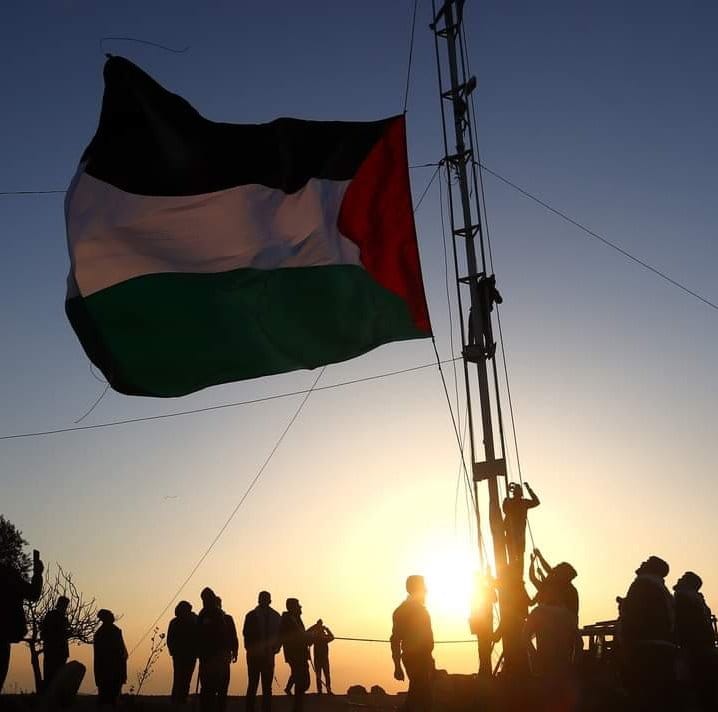
A Palestinian Authority flag flying. Photo: uncredited
Major General Avi Bluth came. He looked around and made the case himself:
- a lookout over the Jordan Valley
- control over the cluster of villages below
- a way to block smuggling from the border into northern Samaria
- a place for an intelligence and observation base
A man who had first been suspicious now approved a farm on the summit, next to a military post. The cabinet later approved turning that farm into a community. A community was also approved on Mount Tammun. A farm on Mount Gadir is supposed to follow, after long delays.
———
Climbing that line of mountains opened a new view of northern Samaria.
The old idea was: “The Jewish communities stay Israeli, but the open land around them belongs to the Arabs.” That idea is collapsing. New Jewish communities on Merom Yehuda, Mount Ebal, and Mount Hazor are examples of the change.
But those mountains are Area C. On many other peaks — Area A or Area B — Israel has so far blocked Jewish footholds. Evictions and demolitions follow any attempt.
The other side does not care what letter Oslo put on the map. If a ridge commands a road or a nearby community, that is where they put a lookout, a flag, a house, or a firing position.
Control around existing communities still matters. But without a presence on the deep inland strongholds, the other side can build a dangerous pocket of its own control.
Last week he wrote about this plan. This week he lists ten mountains he says Israel cannot afford to lose.
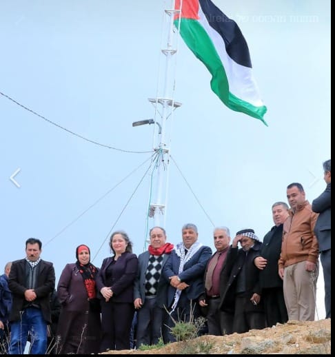
Walid Assaf, the PA official in charge of fighting settlements, raising a flag on Tel Aruma
Ten high points
1. Mount Bezek — 713 meters
On the seam between the Jordan Valley and northern Samaria.
A cattle farm and a new community sit on the summit, plus a small army post. The top is Area C; the western slopes are already Area A. From here you can see the Taysir valley, Mount Gadir, villages to the west, the Gilboa ridge to the north, and large parts of the Jordan Valley. There is another farm on the way up, near Bardala.
2. Mount Gadir — 712 meters
Same seam as Mt. Bezek. Summit Area C; northern and western slopes Area A.
It fully overlooks the city of Tubas and the Tammun valley, all the way to Allon Road and the community of Beka’ot. A farm on the summit was planned almost two years ago. Officials have delayed it. Local activists think it may finally happen soon.
3. Tammun — 588 meters
Lower than the others, but still the third peak in the same wall between highland and valley. It overlooks the Tammun valley and the town below.
The high point is Area B. On the lower eastern side (Area C) a Jewish farm was recently built. The cabinet has approved it as a future official community. The Palestinian Authority took this mountain: A huge PLO flag on the summit, new tracks, and prepared farmland.
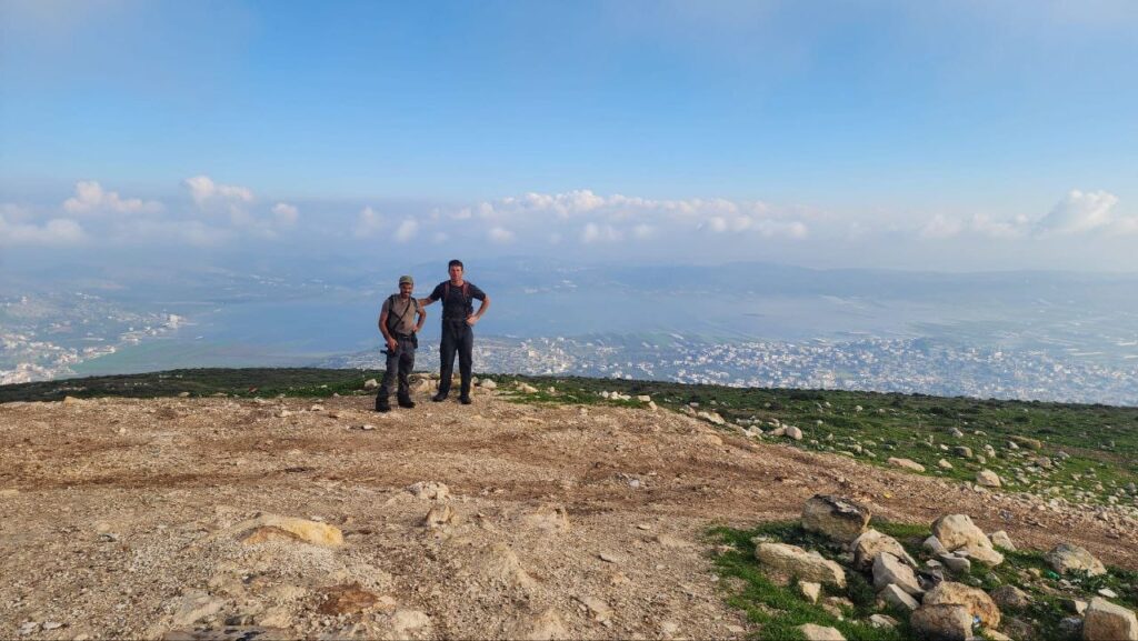
View from Jabal Hureish toward the Sa-Nur valley, flooded in winter. Photo: Hargavim
4. Tel al-Musalla — 430 meters
Area A, above the Dothan Valley in northern Samaria.
It is not very high, but it rises above everything around it. It looks south over northern Samaria and north over the Jezreel Valley. Before the 1967 war, a Jordanian artillery battery here shelled the Ramat David air base. That helped trigger the capture of Jenin.
5. Nahal Irit — 663 meters
A link in the middle of northern Samaria, between the ridges near Homesh and the Bezek–Gadir line. It overlooks Tubas to the east and valleys to the west.
Before Oslo, Israel put a Nahal outpost here because the spot was important. Today the whole mountain is Area A. In recent years it has been used as a training ground for PA forces and as a staging area for the group of would-be slayers of Jews in Tubas.
View from Jabal Hureish looking north. Photo: Hargavim
6. Jabal Hureish — 764 meters
East of Homesh and Sa-Nur. Most of it is Area A; the north is Area B.
This is the most striking high point in the area. It looks over the old Paratroopers training base and the road toward Ganim and Kadim. Unusually, the ridge is still mostly open land, with only thin Arab building. A Jewish foothold here is realistic. Control of Hureish and Nahal Irit together would create a Jewish strip from northern Samaria to the Jordan Valley.
7. Tel Aruma — 843 meters
South of Itamar, between that ridge and Road 505 and the community of Rehavam. Area B.
On the summit is a ruined Hasmonean fortress, one of the most impressive in the country, badly looted. The PA, with people from Beita and Aqraba, has tried to take it: A huge PLO flag, a “resistance tent,” and months of attacks on Jews who tried to reach the site. There was also an illegal dump sending toxic smoke toward nearby communities. After a long fight, the dump was stopped. In recent months there have been efforts to set up a Jewish point here.
8. Jebel Turuja (Jabal Truja) — 801 meters
Between Nofei Nehemia and Ma’ale Levona, on the line between Binyamin and Samaria. It overlooks Highway 60, the Rachelim junction, and nearby communities. Summit, Area A; slopes, Area B.
The PA has put cellular antennas on the peak and is pushing permanent houses. The village of Lubban a-Sharqiya has cut roads and built on the eastern side. On the northern side, the Abu Snina clan from Hebron is trying to put up six buildings. A Jewish community is still possible — but another year or two of delay may be too late.
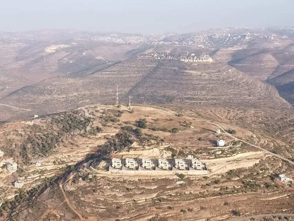
New building on Jebel Turuja by the Abu Snina clan
9. Ridge 917 — about 917 meters
Northwest of Wadi Haramiya in Binyamin. It overlooks Highway 60 and the British Police junction. Summit, Area A; slopes, Area B — even though it sits next to the main road through Judea and Samaria.
After a shooting at that junction in the early 2000s that killed ten people, the PA sped up plans to take the nearby ridges. Roads and houses have been built from Sinjil and Jiljilya so they can later command the highway. The group Regavim fought this in court. The state refused to act, because the land was defined as under PA control. About a year ago a Jewish flock from the Tzur Levavi farm began grazing there. A small permanent point followed.
10. Tel al-Hadab — 797 meters
Southern Hebron Hills, south of Otniel. Area B.
From here you can see the security fence and beyond, and also east. There are already dozens of Arab buildings on the summit, an offshoot of the village of Alqa al-Fuqa (linked in the article to the biblical Upper Golah). Other parts of the mountain are still open and could still take a Jewish foothold.
———
Meir Ettinger and Ben-Zion Efrasimon helped prepare the original article.
In one sentence: Whoever holds these peaks holds the roads, the valleys, and the communities below — and that if Israel waits because of maps, courts, or world pressure, those peaks will be taken by someone else.